For our first blog post here, we’re going to talk about the old trap rock quarries and the ice making industry that flourished in the 19th and early 20th centuries on the Rockland side of the Hudson.
If you stand on Croton Point today and look downriver towards the Mario Cuomo bridge, you’ll see sections where it looks like giant bites have been taken out of the hills across the river:

Here’s a slightly better shot taken from the Metro North train at about Scarborough – you can clearly see the raw rock faces:
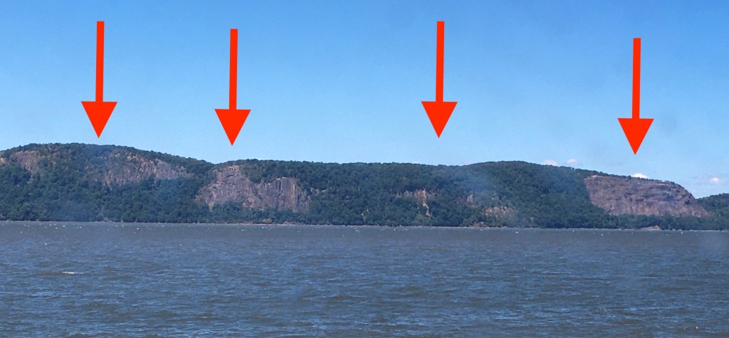
They kind of look like the Palisades south of the bridge, but those are natural features. These scars are most definitely manmade and date from the 19th century rock quarrying industry.
First accomplished through sheer manpower, then through steam-powered stone crushers and dynamite, today’s serene, bucolic surroundings bear little resemblance to the bustling, noisy, dangerous areas they once were when the quarries were active.
Here’s a picture of what one of those working rock quarries looked like back in the day:

This New York Times article from October 1899 gives a sense of the dangerous conditions the quarry workers faced:

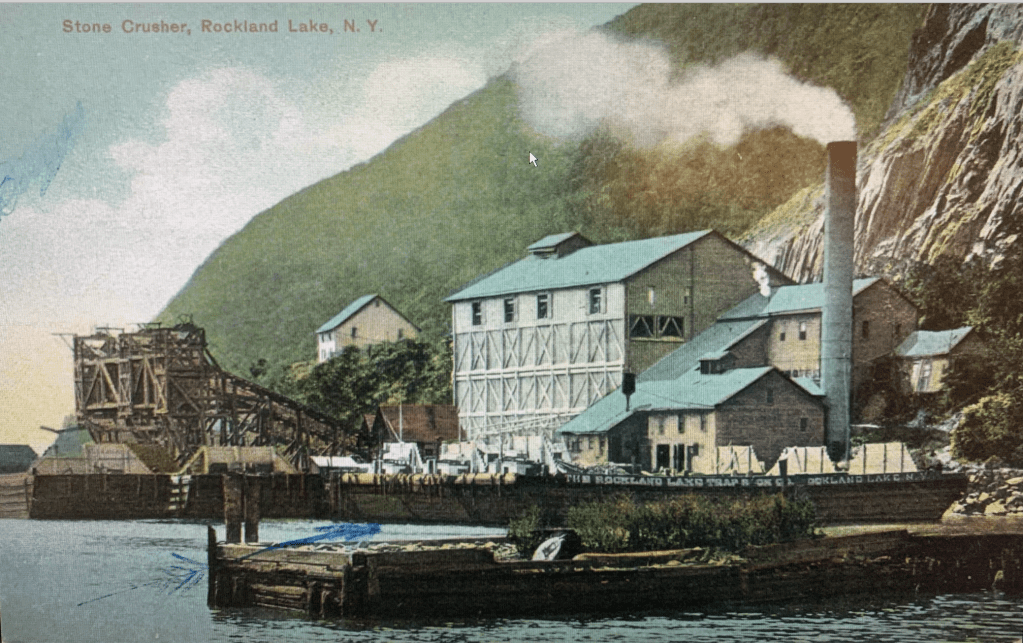
The Rockland Lake Trap Company, mentioned in the above article, owned and quarried much of these riverside hills. Can you imagine what it was like to hear the blasting of the rocks once at noon, and again at the end of the workday? Can you imagine what it was like to work in one of these quarries? And there were active quarries on the Rockland side of the Hudson from Piermont to Haverstraw for decades.
Here’s a postcard with another view of the quarry enterprise:
No wonder the locals started complaining. Over thirty companies were blasting away at the mountains from about the 1870s until about 1920, when the Palisades Interstate Parks Commission (thanks to donations from the likes of the Harriman and the Rockefeller families), bought up the land under the watchful eye of Commissioner George Perkins.
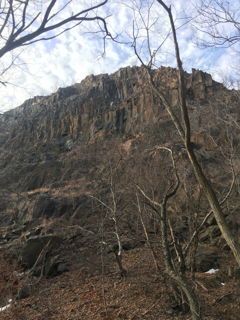
Here’s a close-up of an old quarry as seen from the riverside trail on the Rockland side today:
In addition to the quarries, whose products were used for macadam roads and for the foundations of many a New York City building, the Knickerbocker Ice Company also engaged in a bustling and lucrative business.
Almost directly across from Croton Point, the Knickerbocker Ice Company harvested and transported its ice down the river to customers in New York City and beyond.
If you go across the river, to the Long Path Loop, you’ll find this sign and the ruins of various buildings and ramps that were used to slide the ice down to waiting barges:

In 1711, a man named John Slaughter had purchased this land, extending from the banks of the Hudson, up and over Trough Hollow, and all the back to Rockland Lake. He built a dock and pier on the river which was for years called Slaughter’s Landing.
Now, Rockland Lake was originally called Quaspeck Lake by the Munsee-speaking Lenni Lenape Indians who were here when Henry Hudson sailed past in the Half Moon in 1609. The first Europeans to settle there were the Dutch. However, by the 1660s, the Dutch had handed off the land to the British.
By 1805, ice harvesting began on the lake, and it proved so popular that by 1831 the Knickerbocker Ice Company was formed, and the lake and riverside dock were renamed Rockland. The Lenni Lenape who had been there first had been almost entirely displaced by this time. (Other groups often named in connection with this site include the Ramapough Mountain Indians, the Ramapo Lenape Nation and the Ramapo Lenape Munsee Delaware Nation – no one documenting this today seems able to agree on exactly who they were or what they called themselves.)
Ice was harvested in a systematic and efficient fashion to serve New York City’s ice boxes and restaurants. Rockland Lake, you see, was said to have the “cleanest and purest ice” in the area. During the coldest months of winter, ice was sliced up into blocks, and stored in icehouses in the area, giving employment to the quarry workers who were laid off in the winter months.
Check out this Edison film from about 1905 showing the horse-drawn ice cutters:
By 1856, an incline railway was built in Trough Hollow, the ruins of which you can see if you hike over there (look for the crumbling stone walls to your right as you head down to the river. Imagine small rail cars filled with blocks of ice rolling down to the river to be loaded onto barges and steam ships and transported to the most august eating establishments in New York City.)
Here’s the lower part of what’s left of the incline railway ramp. There are still pier footings in the river below the trail that can be seen during low tides.

With the advent of refrigeration, ice harvesting ended here in 1926, but the land around the lake was developed, and bungalows, resorts, hotels and even casinos for New Yorkers took up the slack until the late 1950s when the entire area was purchased and converted into Rockland Lake State Park.
Check out this drawings of the Rockland Hotel (also see here for more photos and information):

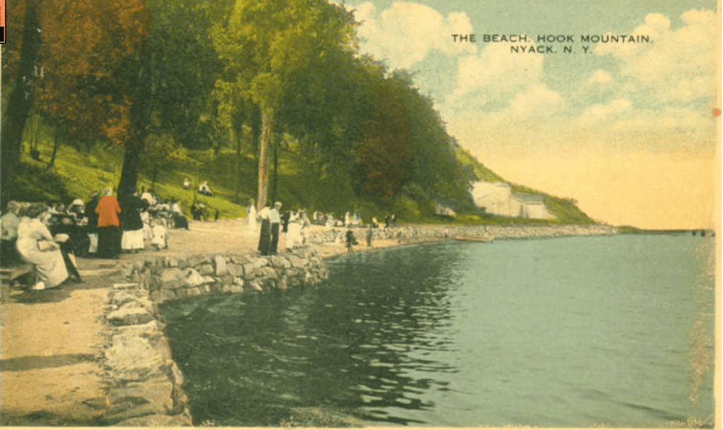
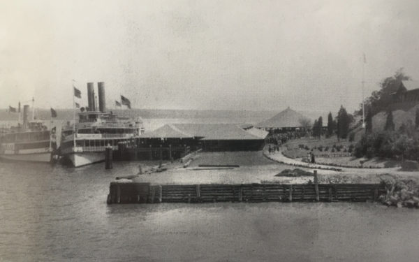
Once the quarries were stilled, beachside parks were developed and Hook Mountain Beach Park was quite elaborate.
Here’s an overview of Hook Mountain Beach Park, in use from about 1920 – 1941:

And here are a few more shots of the heyday of this elegant Hudson River beach:

Sadly, this delightful beach park was shut down in 1942 due to WWII (I don’t know what the connection was, but apparently there was one) and a hurricane in the late 1940s destroyed the park. By the 1950s, no one wanted to let their kids swim in the Hudson anyway because it was so polluted, so the beach park was never rebuilt.
Today, there’s a well-planned and maintained path where you’ll see ruins of old stone buildings – some of which were built for the beach park, some of which are from the quarry period and served as storage sheds for dynamite or offices before being repurposed for the beach park.
We hope you take the time to cross the river, visit the other side and see these sites for yourself!
For further information, here’s a link to the New York/New Jersey Trail Conference map and trail guide:

Leave a comment